Westminster Street facade inventory

I live in the Armory neighborhood of Providence, and mostly use the Westminster Street corridor to get from my house to downtown. It’s an up-and-coming commercial district, with the “hottest new bar” in Providence and many new businesses interested in opening on it.

But, as with even the best, most vibrant commercial strips in any city, there are some lulls in Westminster’s streetscape. Long, blank walls abut the sidewalk on buildings clearly not interested in people walking. Fences impart a “keep out” message. And the most street-deadening feature of all, parking lots either between a building and the sidewalk or worse, taking up a whole lot. When these subconscious barriers are present in a streetscape, they make the neighborhood less walkable, both by making it feel less safe and like it’s a longer walk than it is.

What features would be more welcoming; what could property owners do to encourage potential customers to stop by and spend money? Commercial buildings can have large unobstructed windows to encourage window-shopping (it works for services as well as products). Parking lots can be tucked behind buildings so they don’t create a vacant feeling on the street. And if a property must have a fence for security reasons, they can steer clear of chain link fences and fences that obstruct pedestrians’ view, instead preferring shorter, black ornamental iron fences. And the best thing of all for the streetscape is the presence of lively businesses that have a lot of people coming and going.

Westminster facade legend

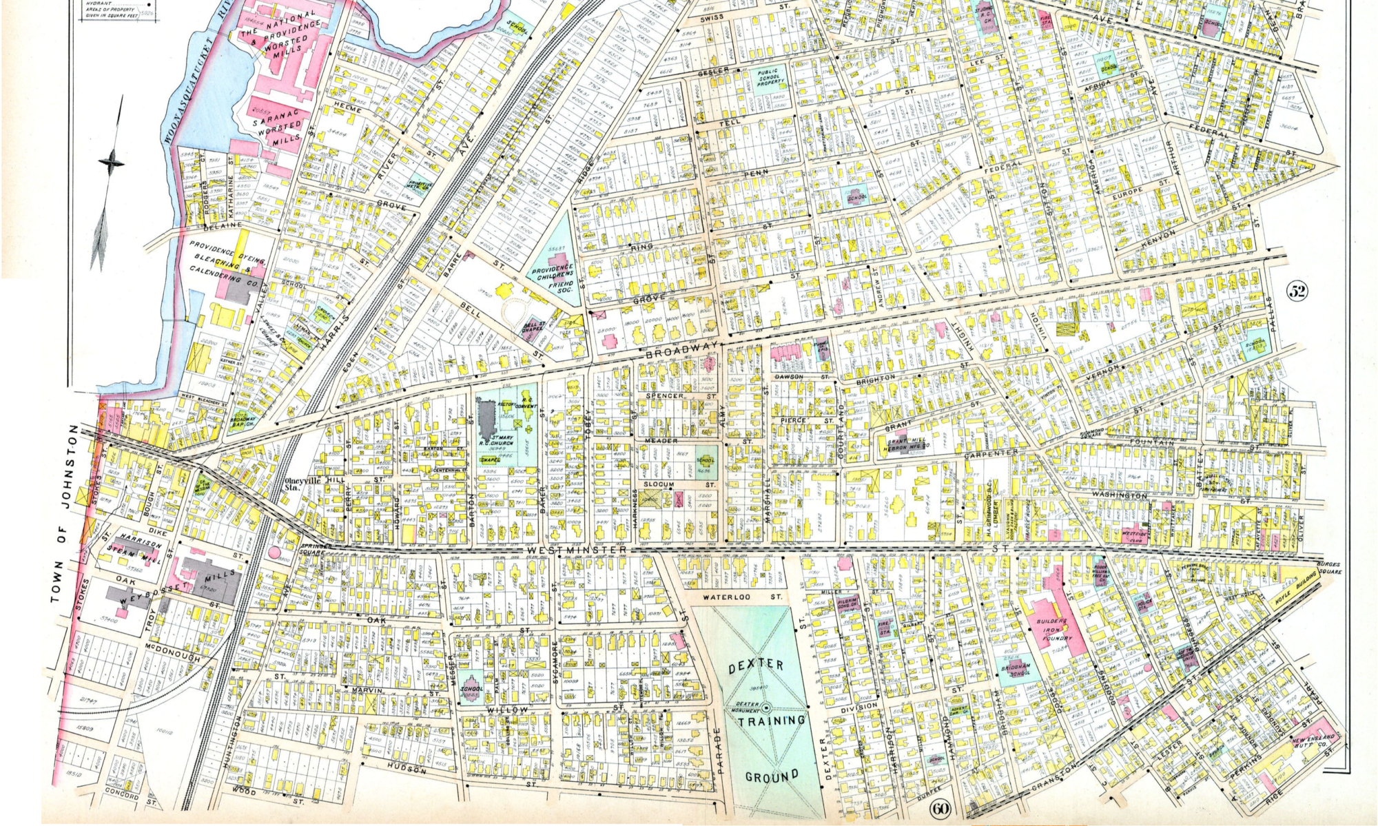
I made a map of the bright spots and dull spots on Westminster Street on the West Side, from highway to highway. These assessments are subjective and perhaps incomplete, but are based on the principles above.

Westminster facade

A few zones of note along the street:

  1. On the east end of the street is Canonicus Square, at the Dean/Cahir crossing. This is the most vibrant part of the streetscape, despite the south side of the street being not especially welcoming to walk on due to the blank facade of the housing tower and the street-adjacent parking lots by the high schools. Why? Because it has a vibrant commercial strip along the north side. Many of these businesses have big windows that invite passers-by to peek and see what’s going on.
  2. The first zone in the middle of the corridor that makes walking less desirable are the one-two punch of the Citizen’s Bank and John Hope House parking lots. These two massive asphalt canyons on the south side of the street make the walk from Winter Street to Bridgham Street seem extremely long. There’s not much across the street from them to invite pedestrians, and John Hope even has an opaque hedge blocking your view. This section of the street sends the message that is for cars to get through as fast as possible and not for people to spend any time.
  3. The second zone in the middle of corridor that could use improvement is the north-side block between Courtland Street and Bridgham Street. There’s one massive vacant parking lot for sale with a big chain link fence around it, Paper & Provision Warehouse that is an active business but features a street-adjacent parking lot and a blank brick facade with no windows, and then another brick building whose facade is essentially blank. The primary two things I can conceive of making this better would be the sale of that vacant parking lot and its development as something people want to walk by, or the renovation of one or both brick building to add bigger windows.
  4. There is a welcoming zone on the western half of the street as well. Between Dexter Street and Parade Street, there are a number of welcoming facades, including the West Side Diner, Community MusicWorks, Loie Fuller’s, and Healing Paws. These good street frontages combined with other facades I classified as neutral (Mi Ranchito with tinted windows, La Perla Fruit Market with covered windows, WBNA set back from the street with hedges obstructing view) make the walk from Parade Street to Fertile Underground seem not very far at all.

Other factors that would make Westminster a more lively commercial corridor would be the addition of bike lanes and sidewalk bump-outs at crosswalks (especially at the wide cross streets Parade & Dexter). Also, it doesn’t take much to fill a dead space on a streetscape. If a really awesome business moved in to either of these dead zones, even across the street from the biggest problem area (e.g. Julian’s Pizza) it would do a lot to enliven the streetscape for the benefit of all businesses and residents of the neighborhood.

Parking in Downtown Providence

In a recent post, I analyzed parking options near the proposed site on the 195 land for a new minor league baseball stadium. I concluded that there are about 7500 parking spaces within a short walk of the location, compared to fewer than 5000 near McCoy Stadium in Pawtucket. Many of those spaces are in private surface lots, and following on the work of Greater City Providence, here are other surface lots deadening downtown:

Good news for downtown

There is some positive movement in replacing desolate surface lots with more productive land use. These locations are colored green above:

  1. Recent news indicates that Buff Chace of Cornish Associates is planning to buy the old Providence Journal building on Fountain Street, as well as its two associated lots across Fountain Street. He plans to develop these two surface lots into multi-story mixed-use buildings.
  2. As soon as three purchase-and-sale agreements are complete on the 195 land, development of a parking garage next to Garrahy Courthouse can commence. The emphasis on ground level retail in this plan makes it good news, as structured parking can strengthen the argument for replacing surface lots. Without ground level retail, a garage would be nearly as bad for downtown’s street life as a surface lot.

More work to be done

There is a long way yet to go, however. Real estate development is not easy, and it is based on hard financial numbers. But based on their size and location, here is my ranked list of important surface lots to develop into buildings:

  1. Westminster & Snow: The two lots on either side of Westminster at Snow Street suck the life out of an otherwise vibrant corridor between Empire Street and Dorrance Street.
  2. Orange & Friendship: This intersection is in the middle of a bleak parking crater. The prime location near the river and Johnson & Wales ought to make this the perfect location for some street-activating land use.
  3. Weybosset & Union: The lot directly behind Grants Block receives a lot of exposure due to that parcel’s revitalized use as public space. It is also in one of the most active parts of downtown. A perfect location with many potential customers walking by.
  4. Washington & Snow: Washington Street is planned as a vibrant cultural corridor, and already has many excellent locations making it active. Despite its relatively small size, this surface lot next to the AS220 building sticks out because the remainder of the streetscape is so continuous.
  5. Clemence & Washington: Located behind the svelte, 13-foot-deep Arnold Building currently under renovation by the Providence Revolving fund, this lot is back from the main street (a quality that makes it less bad than lots that do front main streets) but its size and contribution to the sketch-factor of Clemence Street drive it up on my list. Besides, alleys like Clemence are sexy places to activate these days, and a structure connecting to the back of the Arnold Building and with attractive entrances on Clemence would be spectacular.
  6. Broadway, Atwells, and Greene: This intersection feels super dangerous when you’re walking. Part of that is because of the wide roads with a confusing traffic pattern, but it’s also partly because of the two massive lots serving the Providence Public Library and the Hilton Providence. There’s already a pedestrian barrier of the highway right next to these, and they contribute to an unattractive walk between the dense downtown and two of the West Side’s trendiest commercial corridors.

That’s my list for now. There are a number of other surface lots that could also do with redevelopment, especially in the Jewelry District and abutting the 195 land and the highway, but the above parcels are the most ripe for redevelopment.

On-street market pricing

Any mention of parking in downtown Providence would be incomplete without mention of better management of on-street parking. We have outdated meter technology that does not allow for payment by credit card. We have a flat hourly rate for parking, and free parking in the evening, which lead to the most desirable locations being inaccessible during the times when they are most useful. To fix this, we need new meters that allow for easy payment and easily adjusted pricing, and we need City Council to allow parking rates to change based on demand. There is no reason we should have to drive around for 15-30 minutes looking for on-street parking. The City should optimize parking rates for 85% occupancy of each block at all times of day.

Providence residents want to walk and bike

Last night, Providence’s Bicycle and Pedestrian Advisory Commission (BPAC) held a public forum to establish priorities for the city’s vision for alternative transportation in 2015. More than forty members of the public were present, and about half of those offered recommendations. First, though, the forum was graced by the presence of Mayor Jorge Elorza, who delivered some introductory remarks and then remained present for a whole hour to hear the recommendations of the Providence residents who spoke. Below are my notes on what the Mayor and others said during the meeting.

Mayor Elorza’s remarks

  • It was an inauguration pledge of his to make Providence the most active city in New England. That means being bike- and pedestrian-friendly.
  • The Mayor referred to Bike to Work Week in May, and proclaimed that henceforth in Providence bike commuting would not be relegated to one week of the year, but instead every Friday will be a Bike to Work Day, and he will join residents in commuting by bike.
  • Providence is the perfect city for biking and walking.
  • He has been talking with department heads, and is charging them with integrating a complete streets design approach into their work.
  • He closed with two opportunities that the city will have in the next few months to take steps forward on bicycling and walking:
    1. As soon as the snow allows, Mayor Elorza will sign on to U.S. Secretary of Transportation Anthony Foxx’s Mayors’ Challenge for Safer People, Safer Streets. This challenge calls for mayors to:
      • Issue a public statement about the importance of bicycle and pedestrian safety
      • Form a local action team to advance safety and accessibility goals
      • Take a Complete Streets approach
      • Identify and address barriers to make streets safe and convenient for all road users, including people of all ages and abilities and those using assistive mobility devices
      • Gather and track biking and walking data
      • Use designs that are appropriate to the context of the street and its uses
      • Take advantage of opportunities to create and complete ped-bike networks through maintenance
      • Improve walking and biking safety laws and regulations
      • Educate and enforce proper road use behavior by all
    2. The League of American Bicyclists will have representatives in Providence on April 16th. They will conduct a survey to assess where Providence stands in relation to their Bicycle-Friendly Community standards, and make updated recommendations for how we can attain the next level of bicycle-friendliness. Here are the recommendations they made upon visiting in Fall 2013.

My recommendations

I wrote up a detailed report for BPAC based on those League recommendations, my own assessment of where we stand relative to the Bicycle-Friendly Community standards, new GIS spatial analysis, research on best practices around the country, and talking with members of the bicycle advocacy community in Providence. Below are those recommendations:

  1. In the Executive Order creating BPAC, section 3f states that BPAC will “perform special studies and projects as requested by the City on bicycle and pedestrian questions, including reviewing development plans and site plans which may have significant impact on bicycle and pedestrian transportation.” The street design process should be altered so that BPAC (or the planning department) must review all plans for bicycle & pedestrian impact before they are implemented.
  2. Update the Bike Providence plan with new priorities for improving bicycle infrastructure. See proposed prioritization below.
  3. Adopt the recommendations from the League of American Bicyclists as a work plan for BPAC and pursue a Bronze rating as a Bicycle-Friendly Community.
  4. Encourage the designation of existing staff member as Bicycle & Pedestrian Coordinator or the creation of a new position.
  5. Commend the Mayor for his visibility commuting by bike.
  6. Facilitate the creation of regular training sessions for
    • The public, regarding safe cycling
    • Planning & Public Works staff, on engineering bicycle infrastructure
    • Police Officers, on a “Share the Road” message and traffic law as it applies to bicyclists and motorists.
  7. Encourage the endorsement of NACTO guidelines by the City and the State.
  8. Invite RIDOT and Providence Public Works to be more involved in the Commission.
  9. Encourage Public Works and RIDOT to keep BPAC informed of street redesign project status to ensure Complete Streets features are integrated in a timely & cost effective way.

Infrastructure recommendations

example-of-buffered-bike-lanebetter-lanes

Generally, buffered two-way bike lanes on one side of the street are the best balance between safety, cost, and street width. When street width allows, vertical features should be added in the buffers to further protect the safety of people cycling.

Conventional striped bike lanes should be reserved for locations in which extremely low street width does not provide space for parked cars on both sides of the street, let alone a buffered bike lane. Neither sharrows nor wayfinding signage should be considered bike facilities by themselves; they serve merely to provide additional driver awareness on streets featuring dedicated space for people biking.

Some corridors are more in need of dedicated bicycle facilities than others. See this map for a visual of levels of cycling traffic shown by Strava and VHB apps. These recommendations are based on that data:

  1. Elmwood Ave and Smith Street are suggested in Bike Providence to receive striped bike lanes. These are both corridors that see high use, and the City should use protected bike lanes instead of conventional striping.
  2. Especially Charles Street due to its level of use, but also Douglas Ave, are also recommended for bike lanes in Bike Providence. That recommendation should be implemented, using buffered bike lanes or, if space demands, conventional striped lanes.
  3. North Main Street and Broad Street already see a lot of bicycle traffic. Due to high auto speeds and wide width, protected bike lanes should be created on these corridors.
  4. Downtown has a high level of bicycle use, but no striped bike lanes. Streets downtown seeing the most existing bicycle traffic are Weybosset Street, Washington Street, Dorrance Street, Sabin Street, Fountain Street, Exchange Street, and Exchange Terrace. These streets should be painted with buffered bike lanes.
  5. Cranston Street sees a high level of use for cycling despite its sometimes narrow width. For portions of the corridor where width allows, a protected of buffered bike lane should be created. In the narrowest portions south of the Armory, conventional striped lanes may be necessary.
  6. Olney Street is a primary east-west bicycle route across the East Side, due to its relatively shallow incline. A protected bike lane would be appropriate for this wide street.
  7. Allens Ave has a striped lane, but it is in poor condition. It should be replaced by a protected bike lane because width allows and driving speeds are high.
  8. Olneyville Square and Plainfield Ave toward Neutaconkanut Park are dangerous places for cyclists and yet have a high level of bicycle traffic. A striped bike lane or protected bike lane should be built to improve the safety of these users.
  9. Hope Street, Waterman Street, and Angell Street are important corridors through the East Side, and already see a high level of use for cycling. Buffered or protected bike lanes would be appropriate for street widths on all three streets.
  10. Westminster Street west of 95 sees a high level of bicycle traffic, and is an excellent candidate for a buffered bike lane.
  11. Point Street and Wickenden Street are used a lot by cyclists as paths between the East Side and West Side due to the gentle slope of Wickenden compared to the steep College Hill. Both streets would be strong candidates for a buffered bike lane.
  12. Manton Avenue runs through one of the poorest parts of the city, has high levels of bicycle traffic on it, and connects to the Woonasquatucket River off-road trail. It should be a priority for a buffered lane.

Recommendations from other Members of the Public

  • The Dean Street bridge over the highway is a particularly bad chokepoint for sidewalk snow removal and is particularly dangerous.
  • Prioritize pedestrians where they are.
  • There should be more bike parking in commercial districts.
  • There should be more bike racks at the Amtrak station [BPAC chair Eric Weis commented that in the forthcoming renovation of the train station, there will be more racks].
  • Especially the busiest streets should be ensured of sidewalk snow removal. Especially unsafe for people to walk in the street there.
  • There should be quarterly BPAC forums like this, timed to coincide with the Public Works design cycle.
  • Bill DeSantis, author of the Bike Providence plan for consultant VHB, agreed that the plan is due for updating.
  • National engineering standards such as AASHTO and MUTCD are rapidly changing, with updates dramatically improving design standards for bike and walking safety coming soon.
  • Frank LaTorre of the Downtown Improvement District asserted his organization’s desires to be part of making Providence more bike- and pedestrian-friendly. BPAC chair Eric Weis commended the DID’s “yellow jacket” workers for an excellent job keeping downtown sidewalks clear of snow.
  • Joelle Kanter of the Providence Foundation drew attention to
    1. the CityWalk proposal for connecting India Point Park and Roger Williams Park,
    2. another forum hosted by the Providence Foundation on Monday, March 23rd at 5:30pm on Exchange Terrace, and
    3. a need for cohesive pedestrian wayfinding signage throughout the city to replace and enhance current disjointed signage.
  • Another call for cleared sidewalks, with mention of having RIDOT clear sidewalks on bridges.
  • It is hard for residents to clear the hard-packed snow drifts created by plows which block sidewalks at intersections; perhaps it would be more reasonable to have a systematic approach to these locations.
  • While there is a maintenance contract recently established for the 25 busiest RIPTA stops, perhaps a plan could be created for maintenance of the 1000 busiest RIPTA stops.
  • There needs to be muscle behind walkability & snow removal.

[The mayor left at this point]

  • Reiteration of the especially bad Dean/Atwells intersection area.
  • Crossing the highways is especially tough.
  • Signals downtown are not very functional for people walking, also on the West Side. The city should create a plan to deal with obstacles such as these.
  • Bicycling and walking are part of the city’s sustainability, and should be included in policy in that area.
  • Bicycling and walking are “the sinews of connectivity” in the city.
  • Integration between RIDOT and the City is very important.
  • The train station needs work. The speaker’s bike had been vandalized or stolen at the train station on numerous occasions.
  • The walk from College Hill to the train station is not easy.
  • Snow is hard for families with kids.
  • The sidewalk network is only as strong as its weakest point; if one person hasn’t shoveled in front of their house, parents with young children have to go back home and drive instead.
  • “It will never be easy to own & drive a car in this city, and that’s okay, but it then must be easy to walk.”
  • Why are there no entrepreneurial kids out there doing snow removal? Perhaps there is concern about liability that the City can help alleviate.
  • Slower traffic makes a safer environment for everyone. Consider a 15-20mph speed limit citywide.
  • Overnight on-street parking for residents is great, but where do residential permit holders go in the case of a snow emergency parking ban? In Cambridge, MA, the speaker recalled designated commercial lots that became open to the public at such times.
  • While it is good the city lowered parking minimums in the new zoning code, parking minimums should be eliminated altogether.
  • We have a problem with too many surface parking lots in the city. They should be taxed to disincentivize use of property for commercial parking enterprises.
  • All parking in the city should be metered to distribute demand better.
  • Crosswalks are not always in places that make sense; they should be restriped in places that do. Residents may be able to provide good recommendations on the most logical places for them.
  • It is good that they mayor is encouraging sidewalk snow removal by residents and suggesting that fines may be issued for noncompliance. In North Providence, where the speaker lives, the mayor indicated that there would not be fines, and the speaker has noticed a significant difference in the number of sidewalks cleared in the two cities, approximately 2/3 clear in Providence and approximately 1/3 clear in North Providence.
  • RIDOT should clear bridge sidewalks.
  • Crosswalks should be close to RIPTA stops; too often they are not and that just doesn’t make sense.
  • The bike network is regional, so we should work with other cities to ensure that it is robust.
  • Enforcement of traffic rules is good for safety and should be encouraged.
  • Too often institutions encourage employees and students to drive by subsidizing free parking. The City should encourage its institutions to minimize this practice.
  • The most vulnerable road users should be prioritized in all streets policy.
  • Beyond merely bike racks, the train station renovation should incorporate bike cages.
  • It is important to consider access to grocery stores and other necessities when talking about car and bike usage. We should encourage the location of these facilities in such places that residents who don’t want to or can’t afford a car are able to access them.
  • Another comment about the danger of Dean Street, especially between Kinsley and Atwells.
  • The curve of Wickenden Street was also cited as being dangerous for people walking.
  • Another comment about the difficulty of crossing highways, reference to 95 as “the moat”.
  • “Gotta let a city breathe.” So there should be more porous connections over highways for people walking and bicycling.
  • BPAC Commissioner Jenn Steinfeld made the important point that most of the faces in the room that night were white, and that is often the case with the audience for this commission, despite perhaps a majority of carless households being made up of people of color. How can we change this? We have to hold ourselves accountable to address this misrepresentation. [Someone shouted from the audience “hold meetings outside of working hours!”]
  • Getting young people on bikes is a way to reach their parents who might not otherwise be interested.

And that was it! It lasted about an hour and a half, with the Mayor present for the first hour of that. Also in attendance were Director of Planning Bonnie Nickerson, Deputy Director of Planning Bob Azar, Acting Superintendent of Public Works Bill Bombard, and Director of Policy Sheila Dormody. The official list of recommendations was taken down at the meeting by the planning department’s Associate Director for Special Projects Martina Haggerty, who can be reached at mhaggerty@providenceri.com.

It’s time to stop waiting for the bus in Rhode Island

This post originally published on Rhode Island Future.

I like RIPTA. Transit agencies struggle to provide direly needed transportation access to thousands of people, and they don’t get to take a day off if they’re not feeling up to it. I’ve seen some RIPTA staff in action, and they impress me. I’m also pumped about the redesigned Kennedy Plaza; for all the flak it gets, I think it’s an excellent thing for transit service in Rhode Island and a boon to rejuvenating downtown Providence.

But this is the 21st century.

In the 21st century, people don’t want to wait around in the cold for a bus, because they don’t have to. They have the internet, which can tell them, based on real-time location data, exactly when their bus is going to arrive. Or, maybe they live in an urban area that values its transit system enough to provide frequent enough service such that, even if you miss one bus, the next one will be along before your toes fall off from frostbite.

Unfortunately, neither of those things is true in Rhode Island.

Google Maps and other transit apps are still waiting for RIPTA to provide them with real-time data, instead relying on scheduled bus arrival times. When you’re standing out at a stop in the cold, and you have a meeting or interview you need to get to, what do you do with the statistic that a majority of buses arrive at each stop within 5 minutes of their scheduled time? Do you wait to see if the bus will come? Or do you walk over to the next transit corridor to maybe catch that bus? Or, more likely, you just don’t rely on the bus, because you don’t know whether it can get you there. When you can’t rely on the bus, it’s not a good alternative to car ownership for most people.

Or wait! Even if there’s some major technological, bureaucratic, budgetary, or other reason RIPTA can’t set up a process to format its data in the necessary fashion and provide a feed for Google and other apps (or even *gasp* citizen developers!) it doesn’t matter, right? There are a lot of bus lines; people can rely on the schedule and function pretty okay, yeah?

Except the problem is, RIPTA’s bus service is on the low end of frequency. Transit expert Jarrett Walker categorizes transit service based on off-peak frequency into four categories: buses every 15 minutes or less, every 30 minutes or less, every 60 minutes or less, and occasional service. If you miss those most frequent buses, no worries, because another will be along soon. If you miss the less frequent ones, you know the drill. Walk home, and tell that fantastic job or client you were really excited about that you won’t be able to make it.

So here’s a map of Providence with RIPTA routes colored according to frequency. Red is the best, then blue, then green, then orange is practically nonexistent service.


But look! There are lots of red lines there! Except if you notice, those red lines are mostly along limited-access highways, without much in the way of transit access to the people living next to them. I could count on one hand the corridors outside of downtown with actual frequent transit access:

  1. North Main (paragon of pedestrian friendliness that THAT is)
  2. West Broadway
  3. Cranston Street
  4. Broad
  5. Elmwood
  6. Waterman/Angell
  7. Eddy (only to Thurbers)

Okay I borrowed two fingers from the other hand. But THAT’S IT. No frequent service to RIC or PC. No frequent service to the Wards of City Council members Narducci, Ryan, Correia, Igliozzi, Hassett, or Matos, and hardly any to Councilman Zurier’s Ward 2 or Council President Aponte’s Ward 10. And really, the frequent coverage ain’t great in many other Wards; they just have one or two frequent lines running through them.

Ideally RIPTA would solve both of these problems, but of course there are budgetary constraints and an imperative to cover the whole service area with service. As Walker states in this awesome video (yes I’m a geek), there is a tension between the goal of coverage and the goal of frequency. And indeed, with the R-line and suggestions of further focus on the highest-potential routes, RIPTA is headed more in the direction of frequency than it has been historically.

But the other problem? C’mon RIPTA. We’re living in the 21st century. Get on it. Or tell us why you’re failing in this way. Do you think we don’t care? Or that you’ll look bad? We do care. You already look bad when you don’t tell us why you’re deficient in this area. Here are some links to help get you there if you’re not already on your way: GTFS-realtimeMBTA’s live-feed page. Transit Camp 2015 conference notes.